Pianta Topografica Di Roma
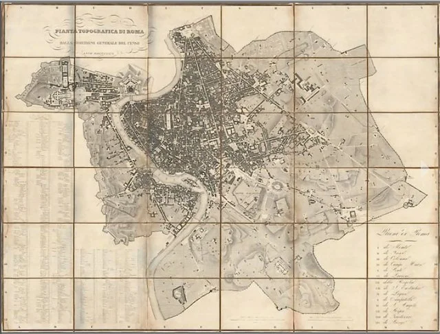
Pianta Topografica Di Roma
Pianta Topografica Di Roma, Dalla Direzione Generale Del Censo, Anno MDCCCXXIX, 1829.
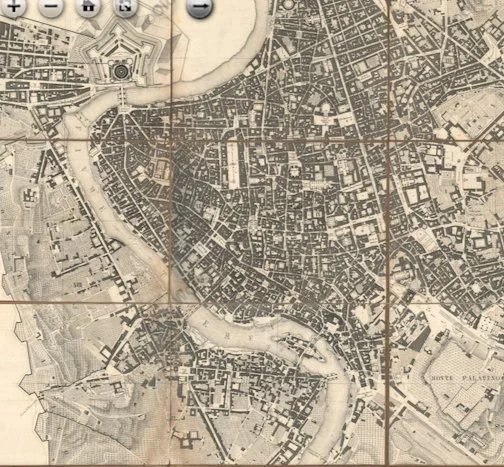
Rare map of Rome with vertical projection, oriented with north at the top. Original publication of the map is the most accurate and significant map of Papel Rome in the nineteenth century. This wall sized wall map is a highly detailed planimetric view of Rome. Streets and sites as well as hundreds of locations are numbered and identified in an extensive index of the XIV (14) districts at bottom left.
Cardinal Cesare Guerrieri, first president of the Congregazione dei Castasti (later Censo) from 1816 to 1832, had this map engraved and published, based on the manuscript of the Castasto Urban ordered by PIO VII in 1818, and completed in 1822.
It is the most accurate image of the city just before it became capital of Italy.
Dimensions are 63” high x 47 1/8” wide
Etching, printed from 4 plates on 4 sheets of contemporary paper, cut, applied on linen, and folded into map box. Dissected in 36 panels and backed with linen.
Condition: A sharp impression with light soiling and some light dampstaining along the edges of some of the dissected panels. There are some small holes and separations in the linen along the folds, and some of the edges of a few panels have lifted a small bit form the linen. Please note: images have some grayish shadows that are not on the map.